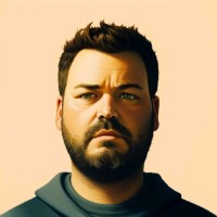
Fran Raga
Senior Geospatial Software Engineer
Senior Geospatial Software Engineer with a background in Cartography and Geodesy and a career focused on desktop GIS, enterprise WebGIS and spatial data infrastructure. I build reliable, scalable solutions with QGIS, Python and PostGIS for national and international organizations — from plugin development and workflow automation to full-stack mapping platforms. I also provide consulting and technical training on open-source GIS.
The tools and languages I use to design, build and ship geospatial software at scale.
A selection of projects from years of GIS development — QGIS plugins, Python tooling and WebGIS applications shared on GitHub.
Main open-source hub — QGIS plugins, Python utilities and geospatial tooling accumulated over years of GIS development.
Production-grade QGIS extensions for workflow automation, spatial data processing and cartographic output.
Custom and enterprise web mapping platforms built with Leaflet, OpenLayers and LuciadRIA for real-world deployments.